
പ്രമാണം:Bedfordshire outline map with UK.png
കൂടുതൽ വ്യക്തതയുള്ള ചിത്രം ലഭ്യമല്ല.
Bedfordshire_outline_map_with_UK.png (504 × 600 പിക്സൽ, പ്രമാണത്തിന്റെ വലിപ്പം: 196 കെ.ബി., മൈം തരം: image/png)
| ഈ പ്രമാണം വിക്കിമീഡിയ കോമൺസിൽ നിന്നുള്ളതാണ്. പ്രമാണത്തെക്കുറിച്ചുള്ള വിവരണം താഴെ കൊടുത്തിരിക്കുന്നു.
|
ചുരുക്കം
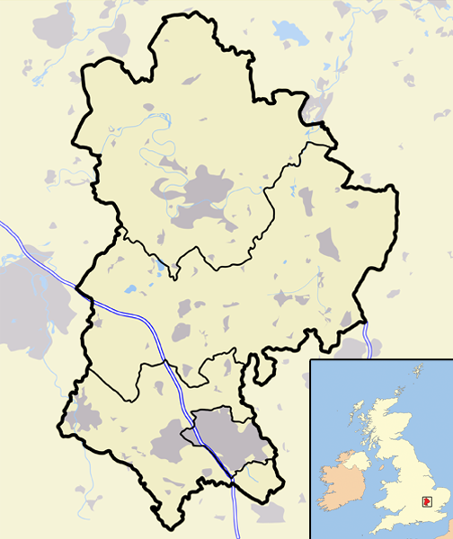
| വിവരണം | A map of the county of Bedfordshire, England, United Kingdom, showing the 1974-2009 district boundaries. |
| തീയതി | |
| സ്രോതസ്സ് | സ്വന്തം സൃഷ്ടി |
| സ്രഷ്ടാവ് | Jhamez84 |
അനുമതി
| ഈ സൃഷ്ടിയുടെ പകർപ്പവകാശ ഉടമയായ ഞാൻ, ഈ സൃഷ്ടി പൊതുസഞ്ചയത്തിൽ പ്രസിദ്ധീകരിച്ചിരിക്കുന്നു. ഇത് ആഗോള തലത്തിൽ ബാധകമാണ്. ചില രാജ്യങ്ങളിൽ ഇത് നിയമപ്രകാരം സാദ്ധ്യമല്ലെന്ന് വന്നേക്കാം; അങ്ങനെയെങ്കിൽ: ഈ സൃഷ്ടി, നിയമപ്രകാരം നിബന്ധനകൾ ഉണ്ടെങ്കിൽ അവയൊഴിച്ച്, യാതൊരു നിബന്ധനകളും ഇല്ലാതെ ഏതൊരാൾക്കും ഏതൊരു ഉപയോഗത്തിനും, ഉപയോഗപ്പെടുത്തുവാൻ ഞാൻ അനുവദിച്ചിരിക്കുന്നു. |
പ്രമാണ നാൾവഴി
ഏതെങ്കിലും തീയതി/സമയ കണ്ണിയിൽ ഞെക്കിയാൽ പ്രസ്തുതസമയത്ത് ഈ പ്രമാണം എങ്ങനെയായിരുന്നു എന്നു കാണാം.
| തീയതി/സമയം | ലഘുചിത്രം | അളവുകൾ | ഉപയോക്താവ് | അഭിപ്രായം | |
|---|---|---|---|---|---|
| നിലവിലുള്ളത് | 20:28, 12 മാർച്ച് 2008 | | 504 × 600 (196 കെ.ബി.) | Jza84 | {{Information |Description=A map of the county of Bedfordshire, England, United Kingdom |Source=self-made |Date=March 2008 |Author= Jhamez84 |Permission=See below |other_versions=None }} |
പ്രമാണത്തിന്റെ ഉപയോഗം
താഴെ കാണുന്ന താളിൽ ഈ ചിത്രം ഉപയോഗിക്കുന്നു:
പ്രമാണത്തിന്റെ ആഗോള ഉപയോഗം
താഴെ കൊടുത്തിരിക്കുന്ന മറ്റ് വിക്കികൾ ഈ പ്രമാണം ഉപയോഗിക്കുന്നു:
- en.wikipedia.org സംരംഭത്തിലെ ഉപയോഗം
- Template talk:Infobox UK place/maps
- Wikipedia:WikiProject UK geography/2009 local government structural changes task force
- 2007 Mid Bedfordshire District Council election
- 2003 Mid Bedfordshire District Council election
- 1999 Mid Bedfordshire District Council election
- 1995 Mid Bedfordshire District Council election
- 1991 Mid Bedfordshire District Council election
- 1987 Mid Bedfordshire District Council election
- 1983 Mid Bedfordshire District Council election
- 1979 Mid Bedfordshire District Council election
- 1976 Mid Bedfordshire District Council election
- 1973 Mid Bedfordshire District Council election
- Module:Location map/data/United Kingdom Bedfordshire 1974-2009
- Module:Location map/data/United Kingdom Bedfordshire 1974-2009/doc
- Module talk:Location map/data/United Kingdom Bedfordshire 1974-2009/doc
- si.wikipedia.org സംരംഭത്തിലെ ഉപയോഗം