
പ്രമാണം:West Yorkshire outline map with UK.png
കൂടുതൽ വ്യക്തതയുള്ള ചിത്രം ലഭ്യമല്ല.
West_Yorkshire_outline_map_with_UK.png (800 × 558 പിക്സൽ, പ്രമാണത്തിന്റെ വലിപ്പം: 407 കെ.ബി., മൈം തരം: image/png)
| ഈ പ്രമാണം വിക്കിമീഡിയ കോമൺസിൽ നിന്നുള്ളതാണ്. പ്രമാണത്തെക്കുറിച്ചുള്ള വിവരണം താഴെ കൊടുത്തിരിക്കുന്നു.
|
ചുരുക്കം
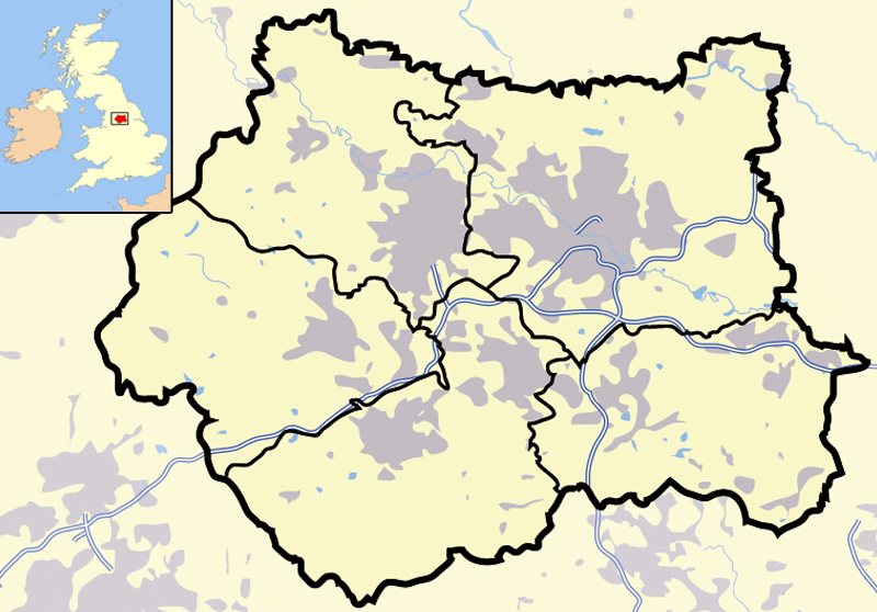
| വിവരണം |
Map of en:West Yorkshire and surrounding area, with indented map of the British Isles for national context. County and borough boundaries in black, urban areas in grey, motorways in blue with white stripe, water bodies in light blue. |
| തീയതി | 9 ഏപ്രിൽ 2007 (യഥാർത്ഥ അപ്ലോഡ് തീയതി) |
| സ്രോതസ്സ് | en.wikipedia പദ്ധതിയിൽ നിന്നും കോമൺസിലേയ്ക്ക് മാറ്റിയത്. |
| സ്രഷ്ടാവ് | ഇംഗ്ലീഷ് വിക്കിപീഡിയ പദ്ധതിയിലെ Jhamez84 |
അനുമതി
| ഈ സൃഷ്ടി അതിന്റെ സ്രഷ്ടാവായ ഇംഗ്ലീഷ് വിക്കിപീഡിയ പദ്ധതിയിലെ Jhamez84, സ്വയം പൊതുസഞ്ചയത്തിൽ പ്രസിദ്ധീകരിച്ചിരിക്കുന്നു. ഇത് ആഗോള വ്യാപകമായി ബാധകമാണ്. ചില രാജ്യങ്ങളിൽ ഇത് നിയമപ്രകാരം സാദ്ധ്യമല്ലെന്ന് വന്നേക്കാം; അങ്ങനെയെങ്കിൽ: ഈ സൃഷ്ടി, നിയമപ്രകാരം നിബന്ധനകൾ ഉണ്ടെങ്കിൽ അവയൊഴിച്ച്, യാതൊരു നിബന്ധനകളും ഇല്ലാതെ ഏതൊരാൾക്കും ഏതൊരു ഉപയോഗത്തിനും, ഉപയോഗപ്പെടുത്തുവാൻ Jhamez84 അനുവദിച്ചിരിക്കുന്നു. |
യഥാർത്ഥ അപ്ലോഡ് രേഖ
ഈ ചിത്രം ആദ്യം അപ്ലോഡ് ചെയ്തത് ഇവിടെ കാണാം. താഴെയുള്ള എല്ലാ ഉപയോക്തൃനാമവും ഉള്ളത് en.wikipedia സംരംഭത്തിൽ ആണ്.
- 2007-04-09 23:11 Jhamez84 800×558×8 (416924 bytes) Map of [[West Yorkshire]] and surrounding area, with indented map of the British Isles for national context. County and borough boundaries in black, urban areas in grey, motorways in blue with white stripe, water bodies in light blue.
പ്രമാണ നാൾവഴി
ഏതെങ്കിലും തീയതി/സമയ കണ്ണിയിൽ ഞെക്കിയാൽ പ്രസ്തുതസമയത്ത് ഈ പ്രമാണം എങ്ങനെയായിരുന്നു എന്നു കാണാം.
| തീയതി/സമയം | ലഘുചിത്രം | അളവുകൾ | ഉപയോക്താവ് | അഭിപ്രായം | |
|---|---|---|---|---|---|
| നിലവിലുള്ളത് | 21:02, 29 ജൂൺ 2007 | | 800 × 558 (407 കെ.ബി.) | Pit-yacker | {{Information |Description=Map of en:West Yorkshire and surrounding area, with indented map of the British Isles for national context. County and borough boundaries in black, urban areas in grey, motorways in blue with white stripe, water bodies in |
പ്രമാണത്തിന്റെ ഉപയോഗം
താഴെ കാണുന്ന താളിൽ ഈ ചിത്രം ഉപയോഗിക്കുന്നു:
പ്രമാണത്തിന്റെ ആഗോള ഉപയോഗം
താഴെ കൊടുത്തിരിക്കുന്ന മറ്റ് വിക്കികൾ ഈ പ്രമാണം ഉപയോഗിക്കുന്നു:
- cs.wikipedia.org സംരംഭത്തിലെ ഉപയോഗം
- en.wikipedia.org സംരംഭത്തിലെ ഉപയോഗം
- en.wikinews.org സംരംഭത്തിലെ ഉപയോഗം
- es.wikipedia.org സംരംഭത്തിലെ ഉപയോഗം
- id.wikipedia.org സംരംഭത്തിലെ ഉപയോഗം
- Chapel Allerton
- Farnley
- Headingley
- Roundhay
- Seacroft
- Shadwell
- Pudsey
- Otley
- Garforth
- Templat:Location map West Yorkshire
- Rothwell
- Wetherby
- Holbeck
- Hunslet
- Armley
- Wortley
- Burley, Leeds
- Cross Gates
- Middleton
- Gipton
- Belle Isle
- Halton Moor
- Moortown
- Alwoodley
- Colton, Leeds
- Oakwood, Leeds
- Adel, Leeds
- Bramley, Leeds
- Katedral Leeds
- it.wikipedia.org സംരംഭത്തിലെ ഉപയോഗം
- qu.wikipedia.org സംരംഭത്തിലെ ഉപയോഗം
- ug.wikipedia.org സംരംഭത്തിലെ ഉപയോഗം