പടിഞ്ഞാറാൻ മേഖല, ഉഗാണ്ട
ദൃശ്യരൂപം
Western | |
|---|---|
| Coordinates: 00°39′S 030°41′E / 0.650°S 30.683°E | |
| Country | ഉഗാണ്ട |
| Region | പടിഞ്ഞാറ് |
| Regional capital | മ്ബരര |
| • ആകെ | 55,276.6 ച.കി.മീ.(21,342.4 ച മൈ) |
| ഉയരം | 1,473 മീ(4,833 അടി) |
(2002 census)[1] | |
| • ആകെ | 62,98,075 |
| • കണക്ക് (2011) | 82,29,800 |
| • ജനസാന്ദ്രത | 110/ച.കി.മീ.(300/ച മൈ) |
| സമയമേഖല | UTC+3 (EAT) |
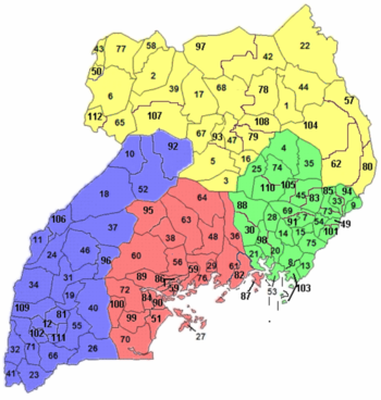
ഉഗാണ്ടയിലെ ഒരു മേഖലയാണ്.[1] As of Uganda's 2002 census, the region's population was 62,98,075.[1] മേഖലയിൽ 26 ജില്ലകളുണ്ട്. ]]:[2]
കുറിപ്പുകൾ
[തിരുത്തുക]- ↑ 1.0 1.1 1.2 1.3 "Uganda: Administrative units (source: Uganda Bureau of Statistics)". GeoHive. Retrieved 18 June 2013.
- ↑ "Uganda: Administrative Division". citypopulation.de. Retrieved 8 November 2016.


