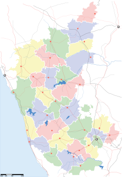
ഫലകം:കർണാടകത്തിലെ സ്ഥലങ്ങൾ
ദൃശ്യരൂപം
| This ഫലകം employs intricate features of template syntax.
You are encouraged to familiarise yourself with its setup and parser functions before editing the template. If your edit causes unexpected problems, please undo it quickly, as this template may appear on a large number of pages. You can conduct experiments, and should test all major changes, in either this template's sandbox, the general template sandbox, or your user space before changing anything here. |
പൂർണ്ണ രൂപം
[തിരുത്തുക]
{{കർണാടകത്തിലെ സ്ഥലങ്ങൾ
|സ്ഥലപ്പേർ=
|അപരനാമം =
|ജില്ല/മഹാനഗരം/പട്ടണം/ഗ്രാമം =
|അക്ഷാംശം =
|രേഖാംശം =
|ജില്ല =
|ഭരണസ്ഥാപനങ്ങൾ =
|ഭരണസ്ഥാനങ്ങൾ =
|ഭരണനേതൃത്വം =
|വിസ്തീർണ്ണം =
|ജനസംഖ്യ =
|ജനസാന്ദ്രത =
|Pincode/Zipcode =
|TelephoneCode =
|പ്രധാന ആകർഷണങ്ങൾ =
|കുറിപ്പുകൾ=
}}
ശ്രദ്ധിക്കുക: അക്ഷാംശവും രേഖാംശവും ഡിഗ്രിയിലാണ് (ദശാംശരൂപത്തിൽ) (decimal degrees) നൽകേണ്ടത്.
ഉദാഹരണം
[തിരുത്തുക]
{{കർണാടകത്തിലെ സ്ഥലങ്ങൾ
|സ്ഥലപ്പേർ= മൈസൂർ
|അപരനാമം =
|ജില്ല/മഹാനഗരം/പട്ടണം/ഗ്രാമം=പട്ടണം
|അക്ഷാംശം= 12.2897
|രേഖാംശം=74.6461
|ജില്ല=മൈസൂർ
|ഭരണസ്ഥാനങ്ങൾ=മേയർ
|വിസ്തീർണ്ണം =
|ജനസംഖ്യ =
|ജനസാന്ദ്രത =
|}}
ഫലം
[തിരുത്തുക]| മൈസൂർ | |
| 12°17′23″N 74°38′46″E / 12.2897°N 74.6461°E | |
| ഭൂമിശാസ്ത്ര പ്രാധാന്യം | പട്ടണം |
| രാജ്യം | ഇന്ത്യ |
| സംസ്ഥാനം | കർണാടകം |
| ജില്ല | മൈസൂർ |
| ഭരണസ്ഥാപനങ്ങൾ | {{{ഭരണസ്ഥാപനങ്ങൾ}}} |
| മേയർ | {{{ഭരണനേതൃത്വം}}} |
| വിസ്തീർണ്ണം | ചതുരശ്ര കിലോമീറ്റർ |
| ജനസംഖ്യ | |
| ജനസാന്ദ്രത | /ച.കി.മീ |
| കോഡുകൾ • തപാൽ • ടെലിഫോൺ |
{{{Pincode/Zipcode}}} +{{{TelephoneCode}}} |
| സമയമേഖല | UTC +5:30 |
| പ്രധാന ആകർഷണങ്ങൾ | {{{പ്രധാന ആകർഷണങ്ങൾ}}} |


