Jump to content

ഫലകം:Infobox German Bundesland/Test states

Coordinates: 53°33′00″N 9°59′00″E / 53.55000°N 9.98333°E / 53.55000; 9.98333
വിക്കിപീഡിയ, ഒരു സ്വതന്ത്ര വിജ്ഞാനകോശം.

Infoboxes for all 16 states.

Be careful with any modifications to the template as some SVG images might have problems. Use this page to check for any wide-ranging effects.

Baden-Württemberg
Flag Coat of arms
Coat of arms of Infobox German Bundesland/Test states
Details
Location
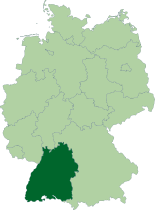
Map of Germany, location of Infobox German Bundesland/Test states highlighted
Time zone CET/CEST (UTC+1/+2)
Administration
Country ജെർമനി Germany
NUTS Region യൂറോപ്പ് DE1
Capital Stuttgart
Minister-President Günther Oettinger (CDU)
Governing parties CDUFDP
Votes in Bundesrat 6 (of 69)
Basic statistics
Area  35,752 km² (13,804 sq mi)
Population 1,07,41,000 (11/2006)[1]
 - Density 300 /km² (778 /sq mi)
Other information
GDP/ Nominal € 331 billion (2005)
Website baden-wuerttemberg.de
Freistaat Bayern
Free State of Bavaria
Flag Coat of arms
Coat of arms of Infobox German Bundesland/Test states
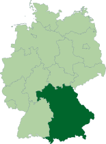
Location
Map of Germany, location of Infobox German Bundesland/Test states highlighted
Time zone CET/CEST (UTC+1/+2)
Administration
Country ജെർമനി Germany
NUTS Region യൂറോപ്പ് DE2
Capital Munich
Minister-President Edmund Stoiber (CSU)
Governing party CSU
Votes in Bundesrat 6 (of 69)
Basic statistics
Area  70,549 km² (27,239 sq mi)
Population 1,24,93,000 (10/2006)[2]
 - Density 177 /km² (459 /sq mi)
Other information
GDP/ Nominal € 404 billion (2005)
Website bayern.de
Berlin

Central Berlin by night seen from the Allianz building
Flag Coat of arms
Coat of arms of Infobox German Bundesland/Test states
Location of Berlin within Europe
Coordinates 52°31′00″N 13°25′00″E / 52.51667°N 13.41667°E / 52.51667; 13.41667
Time zone CET/CEST (UTC+1/+2)
Administration
Country ജെർമനി Germany
NUTS Region യൂറോപ്പ് DE3
City subdivisions 12 Borroughs
Governing Mayor Klaus Wowereit (SPD)
Governing parties SPDLeft
Votes in Bundesrat 4 (of 69)
Basic statistics
Area  892 km² (344 sq mi)
Elevation 34 - 115m
Population 34,05,000 (11/2006)[3]
 - Density 3,818 /km² (9,889 /sq mi)
 - Urban 36,75,000
 - Metro 42,62,480 
Other information
GDP/ Nominal € 79.6 billion (2005)
Postal codes 10001–14199
Area codes 030
Licence plate code B
Website berlin.de
Brandenburg
Flag Coat of arms
Coat of arms of Infobox German Bundesland/Test states
Details
Location
Map of Germany, location of Infobox German Bundesland/Test states highlighted
Time zone CET/CEST (UTC+1/+2)
Administration
Country ജെർമനി Germany
NUTS Region യൂറോപ്പ് DE4
Capital Potsdam
Minister-President Matthias Platzeck (SPD)
Governing parties SPDCDU
Votes in Bundesrat 4 (of 69)
Basic statistics
Area  29,479 km² (11,382 sq mi)
Population 25,48,200 (09/2006)[4]
 - Density 86 /km² (224 /sq mi)
Other information
GDP/ Nominal € 48 billion (2005)
Website brandenburg.de
Freie Hansestadt Bremen
Free Hanseatic City of Bremen
Flag Coat of arms
Coat of arms of Infobox German Bundesland/Test states
Location
Map of Germany, location of Infobox German Bundesland/Test states highlighted
Time zone CET/CEST (UTC+1/+2)
Administration
Country ജെർമനി Germany
NUTS Region യൂറോപ്പ് DE5
State subdivisions 2 urban districts
Capital Bremen
Senate President Jens Böhrnsen (SPD)
Governing parties SPDCDU
Votes in Bundesrat 3 (of 69)
Basic statistics
Area  408 km² (158 sq mi)
Population 6,64,000 (11/2006)[5]
 - Density 1,627 /km² (4,215 /sq mi)
Other information
GDP/ Nominal € 24 billion (2005)
Licence plate code HB
Website bremen.de
Freie und Hansestadt Hamburg
Free and Hanseatic City of Hamburg
Flag Coat of arms
Coat of arms of Infobox German Bundesland/Test states
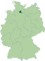
Location
Map of Germany, location of Infobox German Bundesland/Test states highlighted
Coordinates 53°33′00″N 9°59′00″E / 53.55000°N 9.98333°E / 53.55000; 9.98333{{#coordinates:}}: ഒരു താളിൽ ഒന്നിലധികം പ്രാഥമിക ടാഗ് എടുക്കാനാവില്ല
Time zone CET/CEST (UTC+1/+2)
Administration
Country ജെർമനി Germany
NUTS Region യൂറോപ്പ് DE6
First Mayor Ole von Beust (CDU)
Governing party CDU
Votes in Bundesrat 3 (of 69)
Basic statistics
Area  7,55,264 km² (2,91,609 sq mi)
Population 17,54,317 (11/2006)[6]
 - Density 2 /km² (6 /sq mi)
Other information
GDP/ Nominal € 80 billion (2005)
Postal codes 20001–21149, 22001–22769
Area codes 040
Licence plate code HH
Website hamburg.de
Hessen
Hesse
Flag Coat of arms
Coat of arms of Infobox German Bundesland/Test states
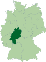
Location
Map of Germany, location of Infobox German Bundesland/Test states highlighted
Time zone CET/CEST (UTC+1/+2)
Administration
Country ജെർമനി Germany
NUTS Region യൂറോപ്പ് DE7
Capital Wiesbaden
Minister-President Roland Koch (CDU)
Governing party CDU
Votes in Bundesrat 5 (of 69)
Basic statistics
Area  21,100 km² (8,147 sq mi)
Population 60,77,000 (08/2006)[7]
 - Density 288 /km² (746 /sq mi)
Other information
GDP/ Nominal € 198 billion (2005)
Website www.hessen.de
Mecklenburg-Vorpommern
Mecklenburg-Western Pomerania
Flag Coat of arms
Coat of arms of Infobox German Bundesland/Test states
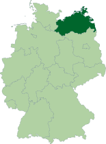
Location
Map of Germany, location of Infobox German Bundesland/Test states highlighted
Time zone CET/CEST (UTC+1/+2)
Administration
Country ജെർമനി Germany
NUTS Region യൂറോപ്പ് DE8
Capital Schwerin
Minister-President Harald Ringstorff (SPD)
Governing parties SPDCDU
Votes in Bundesrat 3 (of 69)
Basic statistics
Area  23,174 km² (8,948 sq mi)
Population 16,94,600 (08/2006)[8]
 - Density 73 /km² (189 /sq mi)
Other information
GDP/ Nominal € 31 billion (2005)
Website m-v.de
Niedersachsen
Lower Saxony
Flag Coat of arms
Coat of arms of Infobox German Bundesland/Test states
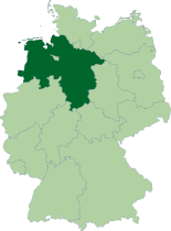
Location
Map of Germany, location of Infobox German Bundesland/Test states highlighted
Time zone CET/CEST (UTC+1/+2)
Administration
Country ജെർമനി Germany
NUTS Region യൂറോപ്പ് DE9
Capital Hanover
Minister-President Christian Wulff (CDU)
Governing parties CDUFDP
Votes in Bundesrat 6 (of 69)
Basic statistics
Area  47,618 km² (18,385 sq mi)
Population 79,84,000 (09/2006)[9]
 - Density 168 /km² (434 /sq mi)
Other information
GDP/ Nominal € 188 billion (2005)
Website www.niedersachsen.de
Nordrhein-Westfalen
North Rhine-Westphalia
Flag Coat of arms
Coat of arms of Infobox German Bundesland/Test states
Location
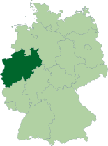
Map of Germany, location of Infobox German Bundesland/Test states highlighted
Time zone CET/CEST (UTC+1/+2)
Administration
Country ജെർമനി Germany
NUTS Region യൂറോപ്പ് DEA
Capital Düsseldorf
Minister-President Jürgen Rüttgers (CDU)
Governing parties CDUFDP
Votes in Bundesrat 6 (of 69)
Basic statistics
Area  34,084 km² (13,160 sq mi)
Population 1,80,33,000 (09/2006)[10]
 - Density 529 /km² (1,370 /sq mi)
Other information
GDP/ Nominal € 489 billion (2005)
Website nrw.de
Rheinland-Pfalz
Rhineland-Palatinate
Flag Coat of arms
Coat of arms of Infobox German Bundesland/Test states
Location
Map of Germany, location of Infobox German Bundesland/Test states highlighted
Time zone CET/CEST (UTC+1/+2)
Administration
Country ജെർമനി Germany
NUTS Region യൂറോപ്പ് DEB
Capital Mainz
Minister-President Kurt Beck (SPD)
Governing party SPD
Votes in Bundesrat 4 (of 69)
Basic statistics
Area  19,847 km² (7,663 sq mi)
Population 40,53,000 (11/2006)[11]
 - Density 204 /km² (529 /sq mi)
Other information
GDP/ Nominal € 97 billion (2005)
Website rlp.de
Saarland
Flag Coat of arms
Coat of arms of Infobox German Bundesland/Test states
Location
Map of Germany, location of Infobox German Bundesland/Test states highlighted
Time zone CET/CEST (UTC+1/+2)
Administration
Country ജെർമനി Germany
NUTS Region യൂറോപ്പ് DEC
Capital Saarbrücken
Minister-President Annegret Kramp-Karrenbauer (CDU)
Governing parties CDUSPD
Votes in Bundesrat 3 (of 69)
Basic statistics
Area  2,569 km² (992 sq mi)
Population 10,44,000 (11/2006)[12]
 - Density 406 /km² (1,053 /sq mi)
Other information
GDP/ Nominal € 27 billion (2005)
Website saarland.de
Freistaat Sachsen
Free State of Saxony
Flag Coat of arms
Coat of arms of Infobox German Bundesland/Test states
Location
Map of Germany, location of Infobox German Bundesland/Test states highlighted
Time zone CET/CEST (UTC+1/+2)
Administration
Country ജെർമനി Germany
NUTS Region യൂറോപ്പ് DED
Capital Dresden
Minister-President Georg Milbradt (CDU)
Governing parties CDUSPD
Votes in Bundesrat 4 (of 69)
Basic statistics
Area  18,416 km² (7,110 sq mi)
Population 42,52,000 (11/2006)[13]
 - Density 231 /km² (598 /sq mi)
Other information
GDP/ Nominal € 86 billion (2005)
Website sachsen.de
Sachsen-Anhalt
Saxony-Anhalt
Flag Coat of arms
Coat of arms of Infobox German Bundesland/Test states
Location
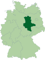
Map of Germany, location of Infobox German Bundesland/Test states highlighted
Time zone CET/CEST (UTC+1/+2)
Administration
Country ജെർമനി Germany
NUTS Region യൂറോപ്പ് DEE
Capital Magdeburg
Minister-President Wolfgang Böhmer (CDU)
Governing parties CDUSPD
Votes in Bundesrat 4 (of 69)
Basic statistics
Area  20,445 km² (7,894 sq mi)
Population 24,44,000 (11/2006)[14]
 - Density 120 /km² (310 /sq mi)
Other information
GDP/ Nominal € 48 billion (2005)
Website sachsen-anhalt.de
Schleswig-Holstein
Flag Coat of arms
Coat of arms of Infobox German Bundesland/Test states
Location
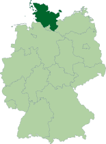
Map of Germany, location of Infobox German Bundesland/Test states highlighted
Time zone CET/CEST (UTC+1/+2)
Administration
Country ജെർമനി Germany
NUTS Region യൂറോപ്പ് DEF
Capital Kiel
Minister-President Peter Harry Carstensen (CDU)
Governing parties CDUSPD
Votes in Bundesrat 4 (of 69)
Basic statistics
Area  15,763 km² (6,086 sq mi)
Population 28,34,305 (11/2006)[15]
 - Density 180 /km² (466 /sq mi)
Other information
GDP/ Nominal € 69 billion (2005)
Website schleswig-holstein.de
Freistaat Thüringen
Free State of Thuringia
Flag Coat of arms
Coat of arms of Infobox German Bundesland/Test states
Location
Map of Germany, location of Infobox German Bundesland/Test states highlighted
Time zone CET/CEST (UTC+1/+2)
Administration
Country ജെർമനി Germany
NUTS Region യൂറോപ്പ് DEG
Capital Erfurt
Minister-President Dieter Althaus (CDU)
Governing party CDU
Votes in Bundesrat 4 (of 69)
Basic statistics
Area  16,171 km² (6,244 sq mi)
Population 23,13,000 (11/2006)[16]
 - Density 143 /km² (370 /sq mi)
Other information
GDP/ Nominal € 44.8 billion (2005)
Website thueringen.de
  1. "State population". Portal of the Federal Statistics Office Germany. Retrieved 2007-04-25.
  2. "State population". Portal of the Federal Statistics Office Germany. Retrieved 2007-04-25.
  3. "State population". Portal of the Federal Statistics Office Germany. Retrieved 2007-04-25.
  4. "State population". Portal of the Federal Statistics Office Germany. Retrieved 2007-04-25.
  5. "State population". Portal of the Federal Statistics Office Germany. Retrieved 2007-04-25.
  6. "State population". Portal of the Federal Statistics Office Germany. Retrieved 2007-04-25.
  7. "State population". Portal of the Federal Statistics Office Germany. Retrieved 2007-04-25.
  8. "State population". Portal of the Federal Statistics Office Germany. Retrieved 2007-04-25.
  9. "State population". Portal of the Federal Statistics Office Germany. Retrieved 2007-04-25.
  10. "State population". Portal of the Federal Statistics Office Germany. Retrieved 2007-04-25.
  11. "State population". Portal of the Federal Statistics Office Germany. Retrieved 2007-04-25.
  12. "State population". Portal of the Federal Statistics Office Germany. Retrieved 2007-04-25.
  13. "State population". Portal of the Federal Statistics Office Germany. Retrieved 2007-04-25.
  14. "State population". Portal of the Federal Statistics Office Germany. Retrieved 2007-04-25.
  15. "State population". Portal of the Federal Statistics Office Germany. Retrieved 2007-04-25.
  16. "State population". Portal of the Federal Statistics Office Germany. Retrieved 2007-04-25.
"https://ml.wikipedia.org/w/index.php?title=ഫലകം:Infobox_German_Bundesland/Test_states&oldid=4111283" എന്ന താളിൽനിന്ന് ശേഖരിച്ചത്