ഫ്രീടൗൺ
ദൃശ്യരൂപം
ഫ്രീടൗൺ | |
|---|---|
 ഫ്രീടൗൺ പട്ടണം | |
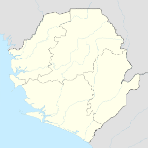
| Coordinates: 8°29′4″N 13°14′4″W / 8.48444°N 13.23444°W | |
| Country | |
| Region | പശ്ചിമ ആഫ്രിക്ക |
| District | Western Area Urban District |
| Founded | March 11, 1792 |
| • Mayor | Franklyn Bode Gibson (APC) |
| • Governing Body | Freetown City Council |
| • ആകെ | 357 ച.കി.മീ.(138 ച മൈ) |
| ഉയരം | 26 മീ(85 അടി) |
(2015 census) | |
| • ആകെ | 1,050,301 |
| സമയമേഖല | Greenwich Mean Time |
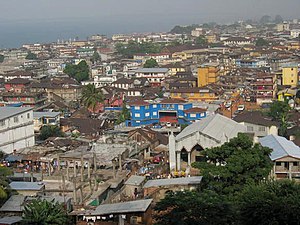
പശ്ചിമാഫ്രിക്കൻ രാജ്യമായ സീറാ ലിയോണിന്റെ തലസ്ഥാനമാണ് ഫ്രീടൗൺ. പടിഞ്ഞാറൻ ആഫ്രിക്കയിലെ ഒരു പ്രധാന തുറമുഖനഗരമാണിത്. രാജ്യത്തെ ഏറ്റവും പ്രധാന സാമ്പത്തിക, സാംസ്കാരിക, രാഷ്ട്രീയകേന്ദ്രമായ ഫ്രീടൗൺ അറ്റ്ലാന്റിക് സമുദ്രത്തിന്റെ കരയിലാണ് നിലകൊള്ളുന്നത്.1792 മാർച്ച് 11ന് ആണ് ഫ്രീടൗൺ നഗരം സ്ഥാപിതമായത്[1]. സീറാ ലിയോൺ നദി അറ്റ്ലാന്റിക് സമുദ്രത്തിൽ ചേരുന്നത് ഫ്രീടൗണിൽ വെച്ചാണ്. 2015 സെൻസസ് അനുസരിച്ച് ഫ്രീടൗൺ നഗരത്തിലെ ജനസംഖ്യ 1,050,301 ആണ്[2][3]. ഇസ്ലാം മതം, ക്രിസ്തുമതം എനന്നിവയാണ് ഫ്രീടൗണിലെ പ്രധാന മതവിഭാഗങ്ങൾ[4].
അവലംബം
[തിരുത്തുക]- ↑ Shaw, Rosalind, Memories of the Slave Trade: Ritual and the Historical Imagination in Sierra Leone. Reconstructed by Mohamed Sheriff, Memphis, Tennessee, University of Chicago Press (2002), p. 37.
- ↑ "Account Suspended" (PDF).[പ്രവർത്തിക്കാത്ത കണ്ണി]
- ↑ "The Future of World Religions: Population Growth Projections, 2010-2050" (PDF). Archived from the original (PDF) on 2015-05-06. Retrieved 12 May 2015.
- ↑ "Sierra Leone Demographic and Health Survey 2013" (PDF). Statistics Sierra Leone and MeasureDHS. January 2014. Retrieved 12 May 2015.
പുറത്തേക്കുള്ള കണ്ണികൾ
[തിരുത്തുക] Freetown എന്ന വിഷയവുമായി ബന്ധമുള്ള കൂടുതൽ പ്രമാണങ്ങൾ (വിക്കിമീഡിയ കോമൺസിൽ)
- 220 Years of Freetown.

