ഗ്രാൻഡ് പ്രയറി
ദൃശ്യരൂപം
ഗ്രാൻഡ് പ്രയറി | ||
|---|---|---|
| City of Grande Prairie | ||
 Skyline of Grande Prairie viewed from the northeast | ||
| ||
| Nickname(s): Swan City[1] | ||
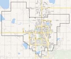
 City boundaries | ||
| Coordinates: 55°10′15″N 118°47′46″W / 55.17083°N 118.79611°W[2] | ||
| Country | Canada | |
| Province | Alberta | |
| Region | Northern Alberta | |
| Planning region | Upper Peace | |
| Municipal district | County of Grande Prairie No. 1 | |
| Federal electoral district | Grande Prairie—Mackenzie | |
| Provincial electoral districts | Grande Prairie Grande Prairie-Wapiti | |
| Incorporated[3] | ||
| • Village | April 30, 1914 | |
| • Town | March 15, 1919 | |
| • City | January 1, 1958 | |
| • Mayor | Jackie Clayton | |
| • Governing body |
| |
| • City Manager | Horacio Galanti | |
| • MP | Chris Warkentin (Conservative) | |
| • MLA | Tracy Allard (UCP) Travis Toews (UCP) | |
(2021)[5] | ||
| • ഭൂമി | 132.71 ച.കി.മീ.(51.24 ച മൈ) | |
| ഉയരം | 650 മീ(2,130 അടി) | |
(2021)[5] | ||
| • ആകെ | 64,141 | |
| • ജനസാന്ദ്രത | 483.3/ച.കി.മീ.(1,252/ച മൈ) | |
| • Municipal census (2018) | 69,088 | |
| • Estimate (2020) | 69,355[7] | |
| സമയമേഖല | UTC−07:00 (MST) | |
| • Summer (DST) | UTC−06:00 (MDT) | |
| Forward sortation areas | ||
| ഏരിയ കോഡ് | 780, , 587, 825, 368 | |
| Highways | 40, 43, 43X | |
| Waterways | Wapiti River Bear River (Bear Creek) | |
| വെബ്സൈറ്റ് | ഔദ്യോഗിക വെബ്സൈറ്റ് | |
ഗ്രാൻഡ് പ്രയറി കാനഡയിലെ വടക്കുപടിഞ്ഞാറൻ ആൽബർട്ടയിലെ പീസ് റിവർ കൺട്രി എന്നറിയപ്പെടുന്ന ഒരു പ്രദേശത്തിന്റെ തെക്ക് ഭാഗത്ത് സ്ഥിതിചെയ്യുന്ന ഒരു നഗരമാണ്. എഡ്മണ്ടണിൽ നിന്ന് ഏകദേശം 456 കിലോമീറ്റർ (283 മൈൽ) വടക്കുപടിഞ്ഞാറായി ഹൈവേ 43 (CANAMEX ഇടനാഴിയുടെ ഭാഗം), ഹൈവേ 40 (ബിഗോൺ ഹൈവേ) എന്നിവയുടെ ഒരു കവലയിലാണ് ഇത് സ്ഥിതിചെയ്യുന്നത്. ഗ്രാൻഡെ പ്രയറി നമ്പർ 1 കൗണ്ടിയാൽ ചുറ്റപ്പെട്ടതാണ് ഈ നഗരം.
63,166[8] ജനസംഖ്യയുള്ള ഗ്രാൻഡെ പ്രയറി 2016-ൽ ആൽബർട്ടയിലെ ഏഴാമത്തെ വലിയ നഗരവും 2001-നും 2006-നും ഇടയിൽ കാനഡയിലെ അതിവേഗം വളരുന്ന നഗരങ്ങളിലൊന്നായിരുന്നു.[9]
അവലംബം
[തിരുത്തുക]- ↑ "History of Grande Prairie". City of Grande Prairie. Archived from the original on 2012-04-28. Retrieved 2012-06-09.
- ↑ "Grande Praire". Geographical Names Data Base. Natural Resources Canada.
- ↑ "Location and History Profile: City of Grande Prairie" (PDF). Alberta Municipal Affairs. June 17, 2016. p. 57. Retrieved June 18, 2016.
- ↑ "Municipal Officials Search". Alberta Municipal Affairs. സെപ്റ്റംബർ 22, 2017. Retrieved സെപ്റ്റംബർ 25, 2017.
- ↑ 5.0 5.1 ഉദ്ധരിച്ചതിൽ പിഴവ്: അസാധുവായ
<ref>ടാഗ്;2021censusഎന്ന പേരിലെ അവലംബങ്ങൾക്ക് എഴുത്തൊന്നും നൽകിയിട്ടില്ല. - ↑ "Alberta Private Sewage Systems 2009 Standard of Practice Handbook: Appendix A.3 Alberta Design Data (A.3.A. Alberta Climate Design Data by Town)" (PDF) (PDF). Safety Codes Council. January 2012. pp. 212–215 (PDF pages 226–229). Archived from the original (PDF) on October 16, 2013. Retrieved October 8, 2013.
- ↑ "Census Subdivision (Municipal) Population Estimates, July 1, 2016 to 2020, Alberta". Alberta Municipal Affairs. March 23, 2021. Retrieved October 8, 2021.
- ↑ "Population and dwelling counts, for Canada, provinces and territories, and census subdivisions (municipalities), 2016 and 2011 censuses – 100% data (Alberta)". Statistics Canada. February 8, 2017. Retrieved February 8, 2017.
- ↑ "Population and dwelling counts, for Canada and census subdivisions (municipalities) with 5,000-plus population, 2006 and 2001 censuses - 100% data". Statistics Canada. 2010-01-06. Archived from the original on 2014-12-15. Retrieved 2012-10-28.


