ബൊണ്ടെബക്ക് ദേശീയോദ്യാനം
ദൃശ്യരൂപം
| Bontebok National Park | |
|---|---|
ഐ.യു.സി.എൻ. ഗണം II (ദേശീയോദ്യാനം) | |
 | |
| Location | Western Cape, South Africa |
| Nearest city | Swellendam |
| Coordinates | 34°04′S 20°27′E / 34.067°S 20.450°E |
| Area | 27.86 കി.m2 (10.76 ച മൈ) |
| Established | 1931 |
| Governing body | South African National Parks |
| www | |
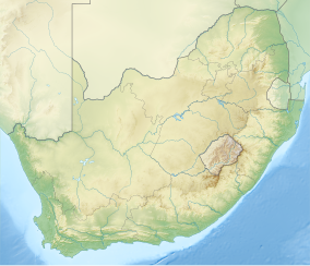
ബൊണ്ടെബക്ക് ദേശീയോദ്യാനം ഒരു പ്രത്യേക ജീവിയിനത്തിൻറെ സംരക്ഷണത്തിനായുള്ള ദക്ഷിണാഫ്രിക്കയിലെ ദേശീയോദ്യാനമാണ്. ബൊണ്ടെബക്കുകളെ സംരക്ഷിക്കുകയെന്ന ലക്ഷ്യം മുൻനിറുത്തിയായണ് 1931 ൽ ഈ ദേശീയോദ്യാനം സ്ഥാപിക്കപ്പെട്ടത്. ദക്ഷിണാഫ്രിക്കയിലെ ആകെയുള്ള 20 ദേശീയോദ്യാനങ്ങളിൽ[1] ഏറ്റവും ചെറുതായ ഈ ദേശീയോദ്യാനം, 27.86 ചതുരശ്ര കിലോമീറ്റർ വിസ്തീർണ്ണമുള്ളതാണ്.[2] ലോക പൈതൃക സ്ഥലത്തിൽപ്പെട്ട കേപ് ഫ്ലോറിസ്റ്റിക് മേഖലയുടെ ഭാഗമാണ് ഈ ദേശീയോദ്യാനം.[3]
ലാൻഗെബർഗ്ഗ് മലനിരകളുടെ[4] താഴ്വാരത്തിൽ സ്ഥിതിചെയ്യുന്ന സ്വെല്ലെൻടം[5] പട്ടണത്തിൽനിന്ന് 6 കിലോമീറ്റർ തെക്കായിട്ടാണ് ഈ ഉദ്യാനം സ്ഥിതി ചെയ്യുന്നത്. ഉദ്യാനത്തിൻറെ തെക്കെ അതിർത്തിയിൽ ബ്രീഡെ നദിയാണ്.
അവലംബം
[തിരുത്തുക]- ↑ South African National Parks. park "Bontebok National Park". Retrieved 2006-08-13.
{{cite web}}: Check|url=value (help) - ↑ South Africa Nature Reserves. "Bontebok National Park" (PDF). Archived from the original (PDF) on 2006-10-07. Retrieved 2006-08-13.
- ↑ South African National Parks. park "Bontebok National Park". Retrieved 2006-08-13.
{{cite web}}: Check|url=value (help) - ↑ South Africa Nature Reserves. "Bontebok National Park" (PDF). Archived from the original (PDF) on 2006-10-07. Retrieved 2006-08-13.
- ↑ Lonely Planet Publications (2004-11-01). Lonely Planet South Africa, Lesotho and Swaziland. Lonely Planet. ISBN 1-74104-162-7.
പുറത്തേക്കുള്ള കണ്ണികൾ
[തിരുത്തുക]![]() വിക്കിവൊയേജിൽ നിന്നുള്ള ബൊണ്ടെബക്ക് ദേശീയോദ്യാനം യാത്രാ സഹായി
വിക്കിവൊയേജിൽ നിന്നുള്ള ബൊണ്ടെബക്ക് ദേശീയോദ്യാനം യാത്രാ സഹായി


