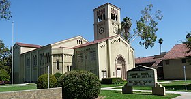
സൗത്ത് പസഡെന
ദൃശ്യരൂപം
സൗത്ത് പസഡെന, കാലിഫോർണിയ | |||||
|---|---|---|---|---|---|
| City of South Pasadena | |||||
| |||||
| |||||
 Location of South Pasadena in Los Angeles County, California | |||||
| Coordinates: 34°6′58″N 118°9′1″W / 34.11611°N 118.15028°W[1] | |||||
| Country | |||||
| State | |||||
| County | |||||
| Incorporated (city) | March 2, 1888[2] | ||||
| • City council[4] | Mayor Robert S. Joe Mayor Pro Tem Diana Mahmud Michael A. Cacciotti Richard D. Schneider Marina Khubesrian | ||||
| • City Treasurer | Gary Pia | ||||
| • City Attorney | Richard L. Adams II | ||||
| • City clerk | Evelyn G. Zneimer[3] | ||||
| • ആകെ | 3.42 ച മൈ (8.85 ച.കി.മീ.) | ||||
| • ഭൂമി | 3.40 ച മൈ (8.82 ച.കി.മീ.) | ||||
| • ജലം | 0.01 ച മൈ (0.03 ച.കി.മീ.) 0.35% | ||||
| ഉയരം | 659 അടി (201 മീ) | ||||
| • ആകെ | 25,619 | ||||
| • കണക്ക് (2016)[7] | 25,913 | ||||
| • ജനസാന്ദ്രത | 7,610.28/ച മൈ (2,937.98/ച.കി.മീ.) | ||||
| സമയമേഖല | UTC-8 (Pacific) | ||||
| • Summer (DST) | UTC-7 (PDT) | ||||
| ZIP code | |||||
| ഏരിയ കോഡ് | 323/626[9] | ||||
| FIPS code | 06-73220 | ||||
| GNIS feature IDs | 1661479, 2411940 | ||||
| വെബ്സൈറ്റ് | www | ||||
സൗത്ത് പസഡെന, അമേരിക്കൻ ഐക്യനാടുകളിലെ കാലിഫോർണിയയിൽ, ലോസ് ഏഞ്ചലസ് കൗണ്ടിയിൽ ഒരു നഗരമാണ്. 2000 ലെ സെൻസസ് പ്രകാരം 24,292 ആയിരുന്ന ഈ നഗരത്തിലെ ജനസംഖ്യ 2010 ലെ യു.എസ്. സെൻസസ് പ്രകാരം 25,619 ആയി വർദ്ധിച്ചിരുന്നു. പടിഞ്ഞാറൻ സാൻ ഗബ്രിയേൽ താഴ്വരയിലാണ് ഇത് സ്ഥിതി ചെയ്യുന്നത്. 3.42 ചതുരശ്ര കിലോമീറ്റർ വിസ്തൃതിയുള്ള ഈ നഗരം ഒരിക്കൽ ഇതിന്റെ ഭാഗമായിരുന്നതും വലിയ നഗരവുമായ പസഡെനയ്ക്കും ലോസ് ആഞ്ചലസ് മെട്രോപ്പോളിസിനും ഇടയിലായാണു സ്ഥിതി ചെയ്യുന്നത്.[11]
ചരിത്രം
[തിരുത്തുക]സൗത്ത് പസഡെനയിലെയും ചുറ്റുപാടുമുള്ള പ്രദേശങ്ങളിലേയും യഥാർത്ഥ നിവാസികൾ തോങ്ക്വ നേഷന്റെ (ഷോഷോൺ ഭാഷാ സമൂഹത്തിന്റെ ഭാഗം) ഒരു ശാഖയായിരുന്നതും ലോസ് ആഞ്ചലസ് തടത്തിലെ അധിവാസികളുമായിരുന്ന തദ്ദേശീയ ഹാഹമോഗ്- നാ ഗോത്രത്തിലെ അംഗങ്ങളായിരുന്നു.
ചിത്രശാല
[തിരുത്തുക]-
കൊളമ്പിയ അവന്യൂ
-
ഗോൾഡ് ലൈൻ ക്രോസിഗ് ഫ്രെമോണ്ട് അവന്യൂ
-
മിഷൻ സ്ടീറ്റിന്റെ വടക്കൻ വശം.
അവലംബം
[തിരുത്തുക]- ↑ 1.0 1.1 "South Pasadena". Geographic Names Information System. United States Geological Survey. Retrieved November 6, 2014.
- ↑ "California Cities by Incorporation Date". California Association of Local Agency Formation Commissions. Archived from the original (Word) on ഒക്ടോബർ 17, 2013. Retrieved ഓഗസ്റ്റ് 25, 2014.
- ↑ "City Clerk's Office". City of South Pasadena. Archived from the original on 2017-11-20. Retrieved January 13, 2015.
- ↑ "South Pasadena City Council". City of South Pasadena. Archived from the original on 2017-11-19. Retrieved January 13, 2015.
- ↑ "2016 U.S. Gazetteer Files". United States Census Bureau. Retrieved Jun 28, 2017.
- ↑ "South Pasadena (city) QuickFacts". United States Census Bureau. Archived from the original on 2012-08-30. Retrieved April 19, 2015.
- ↑ ഉദ്ധരിച്ചതിൽ പിഴവ്: അസാധുവായ
<ref>ടാഗ്;USCensusEst2016എന്ന പേരിലെ അവലംബങ്ങൾക്ക് എഴുത്തൊന്നും നൽകിയിട്ടില്ല. - ↑ "USPS — ZIP Code Lookup — Find a ZIP+ 4 Code By City Results". Retrieved 2007-01-18.
- ↑ "Number Administration System — NPA and City/Town Search Results". Archived from the original on സെപ്റ്റംബർ 26, 2007. Retrieved ജനുവരി 18, 2007.
- ↑ "City Manager's Office". City of South Pasadena. Archived from the original on 2018-04-21. Retrieved February 11, 2015.
- ↑ "City of South Pasadena, California - About South Pasadena". Ci.south-pasadena.ca.us. Archived from the original on 2011-05-14. Retrieved 2011-11-18.


